
How February’s Atmospheric Rivers Affected California’s Water Supply
By Jeffrey Mount and Greg Gartell, Public Policy Institute of California
After a bone-dry January, California experienced four atmospheric rivers in the first two weeks of February. This was a welcome development—January is typically the state’s wettest month and crucial for water supply, and the lack of rain and snow was deeply concerning to many across the state.
But even during this recent period of abundance, there are constraints on how much can be stored or moved around. Addressing these bottlenecks in the system to take better advantage of wet periods will be essential to cope with a changing climate. But it will not be easy, and all approaches are likely to involve costly and controversial trade-offs.
The February storms illustrate some of the challenges the state faces.
Most of early February’s precipitation fell north of Sacramento, with runoff flowing into reservoirs that were at or above their historic averages thanks to two preceding wet years.
Large reservoirs in the Central Valley are operated to meet water supply and flood control objectives.
Rather than storing all the water they can, during the winter reservoir operators are required to maintain enough space in their reservoirs to capture high inflows and reduce the risk of flooding downstream.
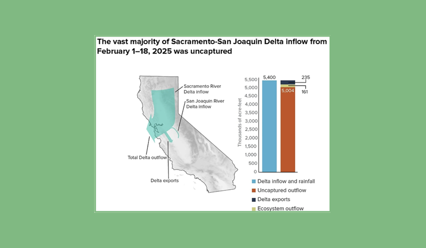
When the February storms arrived, the surge of water into the state’s two largest reservoirs—Shasta and Oroville—quickly filled the flood reserve space. Because the winter flood season is far from over, dam operators had no choice but to let the water go to make space for possible future floods.
And they let go a lot of water. Between February 1 and 18, those two reservoirs alone released more than 2 million acre-feet of water into the Sacramento and Feather Rivers to maintain space for future stormwater. That is a year’s supply for six million homes or 700,000 acres of farmland.



Be the first to comment